0%

Cape Cod Fishing Report Today 🎣

7 months ago · Updated 1 month ago

Cape Cod & Surrounding Waters Fishing Report

GO/NO-GO STATUS

Verdict: CAUTION

Late March on Cape Cod is the definition of transitional early spring fishing. Right now, we are looking at brisk northerly and southwesterly winds pushing 10 to 15 knots, with air temperatures hovering in the chilly 30s and 40s. The marine water temperatures remain stubbornly cold, meaning ocean life is sluggish but slowly waking up from its winter holding patterns. Inland, the ice has cleared from the kettle ponds, signaling the true start of the freshwater season.

Small craft operators should exercise extreme care on the open waters of Cape Cod Bay and Nantucket Sound due to the unpredictable wind chop and the dangers of frigid water temperatures. Shore and nearshore anglers have the green light, but you must prioritize wind-protected coves, estuaries, and bays. Dress in proper thermal, windproof gear—layering is essential. Always wear your personal flotation device (PFD) if you are navigating the shorelines, wading the surf, or launching a kayak.

From the editor

Tired of fishing with strangers you can’t trust?

Nautrek is the first social network for serious anglers — verified partners, real trips, cost splitting and intel sharing without burning your spots. Private beta now open.

Join the Waitlist — Free → 100+ anglers on the list
Nautrek App

SPECIES INTEL

Based on recent, verified biological sampling and citizen science catch data from the past week, we have an accurate, ground-truthed picture of what is moving through the local waters.

Primary Target: Silver Hake (Whiting)

Whiting are highly active right now. Catch data confirms that silver hake are being consistently intercepted by anglers off the Massachusetts coast, ranking as the top observed species in the region. These cold-water predators are schooling up and feeding heavily near the bottom, taking advantage of the early spring bait movements.

Sleeper Pick: Sea Robins (Prionotus)

Often dismissed as a nuisance catch, sea robins are showing up in recent verifiable catch data around the Plymouth area and the upper Cape. They are aggressive, opportunistic bottom-feeders that will strike when other fisheries feel stagnant. They offer surprisingly good rod-bending action and are completely unregulated.

Estuary Wildcard: Ray-Finned Fishes

Recent biological data highlights generalized ray-finned fish activity along the Cape Cod National Seashore and Barnstable County estuaries. In early spring, this points directly to holdover striped bass and white perch waking up in the tidal rivers and backwater salt ponds.

Baitfish Report

Small forage like sand eels and juvenile sea herring are starting to stir in the water column. This is drawing the attention of both the hake and the estuarine predators. You must match the hatch by utilizing slender, metallic profiles to mimic these baitfish, which are currently the primary protein source in the ecosystem.

TACTICAL STRATEGY

To capitalize on the current biological activity, you need to be precise with your presentation. The water is cold, so fish are holding tight to structure and deeper thermal refuges.

  • Where: For Silver Hake and other bottom dwellers, target the deeper channels, drop-offs, and holes. Areas around the Cape Cod Canal approaches, the deeper contours off Provincetown (Race Point), or the 40-to-60-foot ledges in Cape Cod Bay are prime holding zones. Do not waste time in the shallow flats right now; focus on the steep contour lines where the water temperature is slightly more stable. For estuarine holdovers, target the sun-baked mudflats in the back bays during the late afternoon.
  • Lure: Opt for a 2-ounce to 4-ounce diamond jig, such as an AVA jig, or a heavy flutter spoon. The weight is necessary to punch through the currents and stay in the strike zone. For estuary fishing, a 1/2-ounce white bucktail or a 4-inch soft plastic paddletail on a lead sled is ideal.
  • Color: Chrome and silver are mandatory to mimic the sand eels currently present. Add a teaser fly in chartreuse or fluorescent pink tied 18 to 24 inches above your jig to trigger reaction strikes in the stained spring water.
  • Bait: If you prefer soaking bait, utilize a standard high-low bottom rig. Tip your hooks with small, pennant-shaped strips of cut squid or sea clam. Ensure the bait strips flutter naturally in the current rather than spinning uncontrollably.
  • Timing: The bite is heavily tide-dependent. Focus your efforts on the last two hours of the incoming tide and the first hour of the outgoing. Moving water is critical to get the baitfish flushed out of their hiding spots, which in turn triggers the predators to feed.

Pro Tip: When jigging for whiting, keep your lure strictly within the bottom 3 to 5 feet of the water column. They are belly-to-the-sand predators and will rarely chase a jig that is worked too high off the bottom. Use short, rhythmic lifts of the rod tip rather than sweeping vertical jigs.

Pro Tip: If you hook a sea robin, do not just toss it back in frustration! Carefully avoid their flared spines and harvest the tail meat. It is firm, white, and makes for incredible fish tacos or chowder, rivaling many of the more prestigious whitefish.

Pro Tip: When targeting holdover fish in the estuaries, focus your efforts on the late afternoon. The spring sun will warm the shallow mudflats by a degree or two, which is often just enough to trigger a brief but intense feeding window.

REGULATIONS SNAPSHOT

Before heading out, ensure you are compliant with current Massachusetts Division of Marine Fisheries regulations.

For Silver Hake (whiting), there is currently no minimum size limit and no bag limit for recreational anglers, making them an excellent option for the cooler. Sea robins are completely unregulated, meaning no size or bag restrictions apply. If you are targeting holdover striped bass, you must adhere to the strict slot limit of 28 inches to less than 31 inches, with a daily bag limit of one fish per angler. Additionally, inline circle hooks are legally mandated when fishing for striped bass with whole or cut natural bait to reduce release mortality. White perch caught in estuarine waters carry an 8-inch minimum size and a 25-fish daily limit. Always check the state’s marine fisheries portal for emergency updates before hitting the water.

FRESHWATER OUTLOOK

With the inland waters fully opened up, the state’s spring trout stocking program has officially commenced. Hatchery trucks are actively delivering rainbow, brook, and brown trout to the major kettle ponds across Barnstable and Plymouth counties. These freshly stocked fish are highly aggressive and will readily strike small metallic spoons, inline spinners like Panther Martins, or floating dough baits fished on a light slip-sinker rig. Meanwhile, resident largemouth bass and chain pickerel are beginning to stage near the shallow, sun-warmed coves. A suspending jerkbait fished with agonizingly long pauses is the most effective way to coax a bite from these pre-spawn predators.

WEEKEND TIDE & WEATHER NOTES

We are approaching a significant spring moon phase, which will generate larger-than-average tidal swings over the coming days. These amplified currents are a double-edged sword: they will aggressively flush bait out of the salt ponds and ignite feeding frenzies, but they will also require you to upsize your jig weights to effectively hold bottom in the deeper channels. Pay close attention to the changing marine forecast. If the gusts exceed your comfort zone, retreat to the protected south-facing estuaries or pivot entirely to the inland trout ponds. Never underestimate the risk of cold-water immersion this time of year—file a float plan with a trusted contact and stay strictly within your vessel's operational limits.

Tight lines!

Editor's Choice: Must-Have Gear

FISHINGSIR Next-Gen Waterproof Chest Waders

★★★★★ 4.4 (7,370+ reviews)
  • 2-Ply Tech: Upgraded nylon with 2.5x higher density than standard fabrics.
  • 100% Waterproof: Lab-approved intrusion resistance with taped visible seams.
  • Ultra-Lightweight: Designed for all-day comfort while hunting or fishing.
Check Availability on Amazon

✓ Amazon's Choice | 100+ bought last month

🛒 Tactical Gear for this Spot

Bandit Walleye Deep

Mandatory for reaching deep schools in 35-50ft mud flats.

Check Price on Amazon #ad

As an Amazon Associate I earn from qualifying purchases. #ad

Loading forecast...

Live Fishing Conditions: Tides, Weather & Waves

Get real‑time tides, marine weather, swell and solunar activity for each spot so you know exactly when conditions line up for your best chance at a bite.

🎣

Cape Cod

Loading coordinates...

🌤️

WEATHER CONDITIONS

Weather
-- °F
--°C

Loading...

🌡️
Feels Like --°F --°C
💧
Humidity --%
💨
Wind -- mph -- km/h
🧭
Direction --
📊
Pressure -- inHg -- hPa
☀️
UV Index --
🌊

MARINE CONDITIONS

🌊 Wave Height
-- ft
-- m
Loading...
🧭 Wave Direction
--°
Loading...
⏱️ Wave Period
-- s
Loading...
📈 Tide Status
-- ft
-- m
Loading...
🌙

LUNAR & SOLUNAR

🌕

Loading...

Illumination: --%

Major Period --:-- - --:-- --:-- - --:--
Minor Period --:-- - --:-- --:-- - --:--
🌅 Sunrise --:--
🌇 Sunset --:--
📅

24-HOUR FORECAST

Loading fishing conditions...

Fishing Spots Map

🎣
Book a Fishing Charter near Cape Cod Fishing Report Today 🎣

Local guides & charters. Verified captains, instant booking, best price guaranteed.

See Available Trips →

My location
Loading map...

Local Access & Facilities

The Fishery: Cape Cod's Outer Reach

Fishing the elbow of Cape Cod is an exercise in navigating one of the most dynamic and historically significant maritime landscapes in the United States. This is not merely a coastline; it is a shifting frontier of sand, tide, and Atlantic fury that has challenged mariners for centuries. For the serious angler, the waters surrounding Orleans, Chatham, and the Cape Cod National Seashore offer a diverse theater of operation, ranging from the treacherous rips of Monomoy to the serene, flat-calm expanse of the bay side flats. The topography here is defined by the Great Outer Beach, a forty-mile stretch of pristine sand described by Thoreau, which serves as the barrier between the open Atlantic and the fragile ecosystems of the interior marshes.

The atmosphere here is distinctly different from the manicured harbors of the south coast. It is rugged, governed by the rhythms of the Monomoy National Wildlife Refuge and the protected dunes of the National Seashore. Anglers arriving here must be prepared for a fishery that demands self-reliance. Whether you are targeting striped bass in the wash, bluefish in the rips, or making the run offshore for tuna, the logistical reality of the Outer Cape requires careful planning. The infrastructure is present but spread out, often hidden behind the pine forests or tucked away in historic villages. Understanding how to access these waters, where to launch, and where to find critical supplies before the trade winds kick up is as important as selecting the right lure.

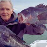
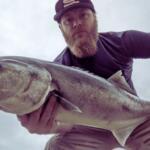
This region acts as a migratory highway for nearly every game fish in the Northeast. The convergence of cold northern currents and the warmer influence of the Gulf Stream offshore creates a nutrient-rich environment that sustains massive bait balls and the predators that hunt them. However, the very geography that attracts the fish—the shifting shoals, the strong currents, and the exposed coastline—makes access a strategic puzzle. From the tidal restrictions of bay-side ramps to the permit-heavy regulations of the federal refuges, local knowledge is the key to unlocking this world-class fishery.

Access & Getting There

Reaching the prime fishing grounds of the Outer Cape invariably involves navigating U.S. Route 6, the Mid-Cape Highway. This two-lane artery is the lifeline of the peninsula, but for the angler towing a boat, it can be a test of patience during the peak summer season. Experienced captains know that timing your arrival is critical; the difference between a breezy drive and a gridlocked nightmare is often a matter of leaving the bridge by 5:00 AM. As you push east past the rotary towards Orleans and Eastham, the highway narrows, and the landscape shifts from suburban sprawl to the scrub pine and dunes characteristic of the National Seashore.

💡 Captain's Tip: Beat the Bridge Traffic

During the summer run, traffic on Route 6 eastbound can back up for miles by mid-morning. Seasoned pros plan their transit to cross the Sagamore or Bourne Bridge before 6:00 AM. If you are towing a wide beam vessel, early morning transit is not just a convenience; it is a safety necessity on the narrower stretches of the outer highway.

For boaters, the launch situation requires acute attention to the tides. Boat Meadow Landing in Eastham offers access to the bay side, but it is highly tide-dependent. The flats here run dry for extensive distances at low water, meaning a miscalculation can leave you high and dry on the mud for six hours. This ramp is best suited for skiffs and shallow-draft vessels targeting the flats. For those looking to access the Atlantic side or the rips around Monomoy, the access points further south in Chatham, such as the area near Ryder's Cove, provide the necessary gateway, though parking can be scarce and often restricted to residents or those with specific permits during the high season.

Shore fishing access is abundant but physically demanding. The Cape Cod National Seashore allows for over-sand vehicle travel in specific zones, but this requires a specialized permit and strict adherence to equipment requirements (tire pressure gauges, tow straps, full-sized spares). For those on foot, access points like Fort Hill Road in Eastham offer parking and proximity to the water, but be prepared for a hike. The terrain is soft sand and steep dunes; hauling gear to the water's edge is a workout. The Monomoy National Wildlife Refuge is accessible via Morris Island Road to Wikis Way, where limited parking allows for a walk to the water, though much of the refuge itself is a designated wilderness area with restricted access to protect nesting shorebirds.

Weather plays a definitive role in accessibility. The "Elbow" of the Cape is exposed to the full fetch of the Atlantic. When the Northeast wind blows, the outer beaches become unfishable surf zones. In these conditions, the savvy angler retreats to the leeward side in Cape Cod Bay or the protected harbors. Conversely, a strong Southwest wind can make the bay side choppy while flattening out the surf on the ocean side, provided the swell isn't too large. Always have a "Plan B" launch point in mind based on the wind direction, as conditions can change rapidly on this narrow spit of land.

Cape Cod Pre-Trip Checklist

Facilities & Amenities

The infrastructure on the Outer Cape is robust but decentralized. You will not find a single "superstore" that services the entire fleet; rather, the area is dotted with specialized independent shops that cater to specific styles of fishing. For fresh bait and local intelligence, No Fly Zone Fishing on Cold Storage Road in South Dennis is a key stop for those coming from the mid-cape. While it is an 8.6-mile drive from the central fishing grounds of Orleans, their hours (7:00 AM to 7:00 PM daily) make them a reliable waypoint. Further east, Harwich Sport Bait & Tackle LLC on Main Street (MA-28) in Harwich Port is a staple for the local fleet, offering a wide selection of terminal tackle suited for the rips and shoals.

For captains requiring heavy offshore gear or specialized marine equipment, Cape Cod Outfitters Fishing in Barnstable is the heavyweight in the region. Located on Freezer Road, they are known for servicing the serious offshore crowd. Note that this is a significant drive back west (approximately 17 miles from Orleans), so gear failures should be addressed before you hit the final stretch of Route 6. If you are looking to charter a vessel rather than trailer your own, the local fleet is world-class. Monomoy Sportfishing, operating out of Ryder's Cove Road in Chatham, specializes in the unique rip fishing of the area. For those chasing bluefin or shark offshore, Blue Bandit Fishing Charters in Harwich Port and Schooney Charter Fishing in Truro run substantial vessels capable of handling the offshore swell.

💡 Captain's Tip: Fuel Logistics

Fuel docks are few and far between on the Outer Cape compared to other major fisheries. If you are trailing a boat, fill your tank at a highway gas station before you turn off Route 6 towards the ramp. The price difference is significant, and many smaller landings like Boat Meadow have absolutely no facilities—no fuel, no ice, and no water.

Lodging for the traveling angler is a unique highlight of this region. The National Park Service manages several historic properties that are available for rent, placing you directly inside the fishing grounds. The Le Count Beach House in Wellfleet is a renovated two-bedroom home nestled in the pine trees, just a short walk to Le Count Beach. For larger crews, the Sunrise House on Pilgrim Road sleeps ten and sits on a bluff overlooking the Atlantic, offering the ultimate "dawn patrol" advantage—you can check the surf conditions from your deck while drinking your morning coffee. Similarly, the Ocean View House offers a one-bedroom setup with dramatic ocean views. These properties require a minimum stay and fill up fast, but they offer an immersion in the fishery that a standard motel cannot match. For more traditional lodging, the Eagle Wing Inn in Eastham and Harborside Village in Wellfleet provide reliable accommodations close to the main roads.

Permits, Regulations & Fees

Fishing the Outer Cape requires navigating a complex layer of federal, state, and local regulations. First and foremost, a Massachusetts Saltwater Recreational Fishing Permit is mandatory for all anglers aged 16 and older. This applies to both boat and shore fishing. The permit is part of the national registry system and aids in the management of coastal stocks. Enforcement is active, particularly at popular access points like Ryder's Cove and the National Seashore beaches.

The Cape Cod National Seashore and Monomoy National Wildlife Refuge introduce federal overlays to the standard state rules. Monomoy is home to the only federally designated Wilderness Area in Southern New England. This designation (covering 3,500 acres) means that motorized equipment and mechanical transport are strictly prohibited in specific zones. While fishing is a recognized priority use, you must be hyper-aware of where you step and land your boat. Large sections of the beach are often closed seasonally to protect nesting Piping Plovers and Roseate Terns. These closures are not suggestions; they are federal laws with significant fines for violations. The "symbolic fencing" (string and posts) protecting nesting areas is sacrosanct.

Parking and access fees are another consideration. The National Seashore charges daily fees for beach parking during the season, and town landings often require a resident sticker or a paid daily pass for trailers. At Monomoy, the parking lot at Wikis Way is limited. If you are booking one of the NPS rental properties like the Sunrise House or Le Count Beach House, verify the parking allocation for your trailers, as driveways like the gravel back-in at Le Count have strict vehicle limits (max 2 vehicles). Cultural respect is also paramount; many access points traverse historic lands. The Nauset and Monomoy areas have deep indigenous history, and artifacts or protected grounds must be respected absolutely.

Events & Seasonal Information

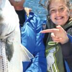
The fishing calendar on Cape Cod is dictated by migration. The spring run typically ignites in May as schoolie stripers push into the bays and estuaries, followed by the larger cows in June. Summer sees the arrival of bluefish and the establishment of the offshore tuna bite. However, the "Fall Run" is the legendary season here. Starting in September and running through October, the blitzes of bass and blues chasing bait along the Outer Beach are world-famous. This is when the surfcasters descend on the beaches from Nauset to Race Point.

Tournament season peaks in high summer, particularly for the offshore fleet targeting billfish and tuna. While specific dates shift annually, the presence of tournament boats can crowd the few available fuel docks and ramps in Harwich and Chatham. If you are not competing, it is wise to launch early or late to avoid the "shotgun start" rush at the major marinas.

Daily timing is heavily influenced by the distinct micro-climates of the Cape. The prevailing Southwest trade winds often kick up by 10:00 AM, chopping up the bay and creating heave on the ocean side. The "magic hour" for the flats fisherman is the pre-dawn window before the wind builds. Furthermore, the tidal range here is significant. Navigating the cuts and channels around Monomoy requires a tide chart and a depth sounder; the "islands" and shoals move and shift with winter storms, so last year's waypoints may now be dry sand.

💡 Captain's Tip: Seal Awareness

Monomoy is home to the largest gray seal haul-out on the U.S. Atlantic Coast (30,000-50,000 seals). Where there are seals, there are Great White Sharks. Wade fishing in deep water or near drop-offs around Monomoy and the outer beaches is discouraged. Keep your catch in the boat or bring it to the sand immediately; do not tow fish on a stringer while wading.

Contact Information & Resources

For the most current information on beach closures, access permits, and facility status, direct communication with the managing agencies is recommended. The Monomoy National Wildlife Refuge headquarters can be reached at 508-945-0594 or via email at r5wmnwr@fws.gov. Their visitor center is located at 30 Wikis Way, Chatham, MA. For inquiries regarding the Cape Cod National Seashore, including the specific rental properties like the Sunrise House, contact the leasing office at 508-957-0743 or cacoleasing@nps.gov. The general park information line is (508) 255-3421.

In terms of safety, cell service can be spotty in the dunes and offshore. A VHF radio is standard equipment for any vessel leaving the inlet. TowBoatUS and Sea Tow maintain a strong presence in the area due to the high frequency of groundings on the shifting shoals. Always file a float plan, especially if heading toward the rips or the wilderness areas of Monomoy where foot traffic is non-existent.

For precise locations of the boat ramps, bait shops, and real-time wind conditions, consult the live dashboard and interactive maps below.

🎣

Cape Cod

Orleans • Massachusetts • 41.7988, -69.9961
🅿️

Parking

5
Flax Pond Beach Parking
⭐ 5.0 2.7 mi
📍 QX7G+VX, Brewster, MA 02631, USA
🚗 Get Directions
Car park - free
⭐ 4.7 2.2 mi
📍 99-1 Fort Hill Rd, Eastham, MA 02642, USA
🚗 Get Directions
🐟

Bait & Tackle

3
No Fly Zone Fishing
⭐ 5.0 8.6 mi
📍 81 Cold Storage Rd, South Dennis, MA 02660, USA
🕒
Monday: 7:00 AM – 7:00 PM
Tuesday: 7:00 AM – 7:00 PM
Wednesday: 7:00 AM – 7:00 PM
Thursday: 7:00 AM – 7:00 PM
Friday: 7:00 AM – 7:00 PM
Saturday: 7:00 AM – 7:00 PM
Sunday: 7:00 AM – 7:00 PM
🚗 Get Directions
Cape Cod Outfitters Fishing
⭐ 5.0 16.9 mi
📍 92 Freezer Rd, Barnstable, MA 02630, USA
🕒
Monday: Open 24 hours
Tuesday: Open 24 hours
Wednesday: Open 24 hours
Thursday: Open 24 hours
Friday: Open 24 hours
Saturday: Open 24 hours
Sunday: Open 24 hours
🚗 Get Directions
HarwichSport Bait & Tackle LLC
⭐ 4.9 10.0 mi
📍 431 MA-28, Harwich Port, MA 02646, USA
🕒
Monday: 9:00 AM – 4:00 PM
Tuesday: 9:00 AM – 4:00 PM
Wednesday: Closed
Thursday: 9:00 AM – 4:00 PM
Friday: 9:00 AM – 4:00 PM
Saturday: 9:00 AM – 5:00 PM
Sunday: 9:00 AM – 2:00 PM
🚗 Get Directions
🚤

Fishing Charters

5
Cape Cod Family Charters
⭐ 5.0 16.9 mi
📍 200 Millway, Barnstable, MA 02630, USA
🕒
Monday: Open 24 hours
Tuesday: Open 24 hours
Wednesday: Open 24 hours
Thursday: Open 24 hours
Friday: Open 24 hours
Saturday: Open 24 hours
Sunday: Open 24 hours
🚗 Get Directions
Salty Fly Cape Cod Fishing Charters
⭐ 5.0 16.9 mi
📍 126 Freezer Rd, Barnstable, MA 02630, USA
🕒
Monday: 5:00 AM – 9:30 PM
Tuesday: 5:00 AM – 9:30 PM
Wednesday: 5:00 AM – 9:30 PM
Thursday: 5:00 AM – 9:30 PM
Friday: 5:00 AM – 9:30 PM
Saturday: 5:00 AM – 9:30 PM
Sunday: 5:00 AM – 9:30 PM
🚗 Get Directions
Schooney Charter Fishing
⭐ 5.0 14.6 mi
📍 2 Josephs Rd, Truro, MA 02666, USA
🕒
Monday: 6:00 AM – 9:00 PM
Tuesday: 6:00 AM – 9:00 PM
Wednesday: 6:00 AM – 9:00 PM
Thursday: 6:00 AM – 9:00 PM
Friday: 6:00 AM – 9:00 PM
Saturday: 6:00 AM – 9:00 PM
Sunday: 6:00 AM – 9:00 PM
🚗 Get Directions
Monomoy Sportfishing
⭐ 5.0 6.6 mi
📍 Ryder's Cove Rd, Chatham, MA 02633, USA
🕒
Monday: 6:00 AM – 6:00 PM
Tuesday: 6:00 AM – 6:00 PM
Wednesday: 6:00 AM – 6:00 PM
Thursday: 6:00 AM – 6:00 PM
Friday: 6:00 AM – 6:00 PM
Saturday: 6:00 AM – 6:00 PM
Sunday: 6:00 AM – 6:00 PM
🚗 Get Directions
Blue Bandit Fishing Charters
⭐ 5.0 9.5 mi
📍 715 Main St, Harwich Port, MA 02646, USA
🕒
Monday: 4:00 AM – 9:00 PM
Tuesday: 4:00 AM – 9:00 PM
Wednesday: 4:00 AM – 9:00 PM
Thursday: 4:00 AM – 9:00 PM
Friday: 4:00 AM – 9:00 PM
Saturday: 4:00 AM – 9:00 PM
Sunday: 4:00 AM – 9:00 PM
🚗 Get Directions
🏠

Lodging

5
Harborside Village
⭐ 5.0 9.4 mi
📍 Kendrick Ave, Wellfleet, MA 02667, USA
🚗 Get Directions
Eagle Wing Inn
⭐ 4.8 1.4 mi
📍 960 State Hwy, Eastham, MA 02642, USA
🕒
Monday: Open 24 hours
Tuesday: Open 24 hours
Wednesday: Open 24 hours
Thursday: Open 24 hours
Friday: Open 24 hours
Saturday: Open 24 hours
Sunday: Open 24 hours
🚗 Get Directions

Boat Ramps

3
🚻

Restrooms

3
👨‍👩‍👧‍👦

Family Friendly

2

Accessibility

Wheelchair Access

Not Confirmed

🐕

Pets Allowed

Not Confirmed

⚠️ Some accessibility info not officially confirmed. Please verify with location directly.

📍 Showing 26 facilities on map
🎣
Book a Fishing Charter near Cape Cod Fishing Report Today 🎣

Local guides & charters. Verified captains, instant booking, best price guaranteed.

See Available Trips →

📊

About Our Fishing Reports & Forecasts

Our spot reports combine data-driven forecasts with curated local information. The forecast is generated by our proprietary Fishing Score algorithm (0–100%), which analyzes real-time data from Open-Meteo API, validated against NOAA CO-OPS tide gauges and USGS water-monitoring stations. The model weights tide dynamics (35%), wave energy (25%), wind patterns (20%) and time of day (20%)—factors shown to influence fish feeding behavior through marine-biology research and decades of charter log data.

Access, facilities and services information for each fishing spot is sourced from official datasets such as Recreation.gov (RIDB), state park & wildlife agencies, and geospatial providers like Google Maps. These sections undergo scheduled re-validation every 3–6 months to ensure that boat ramps, park access, contact details and local services remain accurate.

Narrative sections (catches, seasonal behavior, local tips) are synthesized from these data sources and refined following the Fishing Reports Today editorial guidelines, combining bibliographic research from ichthyology and oceanography with expert angler experience. Our team reviews reports on a regular basis, while the forecast model itself updates every 6 hours for real-time accuracy.

⚠️ Important: Always verify current local regulations, access restrictions and weather conditions before fishing. These reports are intended as a planning aid, not a guarantee of catches or safety. When in doubt, contact local authorities or park managers listed on the page.

Learn more about our methodology & data sources

Leave a Reply

Your email address will not be published. Required fields are marked *