We are currently experiencing a classic split-season scenario in the Westbrook area. The transition from hardwater to open water creates highly variable conditions that require careful navigation and situational awareness.
River Fishing (Open Water): GO. The tailwaters below Saccarappa Falls, Mallison Falls, and the lower stretches of the Presumpscot River are flowing freely and offer excellent open-water access for both wading and shore anglers.
Ice Fishing: UNSAFE - TRY ALTERNATIVE. Do not trust the remaining ice on local bodies of water like the Otter Ponds or the coves of Sebago Lake. The higher spring sun angle and fluctuating temperatures have severely rotted the black ice, making it entirely unpredictable and dangerous.
Safety Advisory: While the river is open, the banks remain treacherous. Freeze-thaw cycles have glazed shoreline rocks and trails with invisible black ice. Wading anglers must wear studded boots or cleats. Additionally, exercise extreme caution when wading, as spring runoff can cause sudden spikes in flow rates, drastically altering the river's depth and current speed throughout the day.
Weather Impact: Expect a mix of bright, sunny days and intermittent spring showers. The warm spikes reaching into the upper 40s will trigger distinct mid-day feeding windows, but this rapid melting will also introduce stained, cold runoff into the river system, temporarily affecting water clarity.
2. SPECIES INTEL
The Westbrook fishery is incredibly diverse during the spring transition, offering opportunities for both cold-water purists and warm-water predator hunters. The recent conservation efforts and fishway improvements have truly revitalized this urban watershed.
From the editor
Tired of fishing with strangers you can’t trust?
Nautrek is the first social network for serious anglers — verified partners, real trips, cost splitting and intel sharing without burning your spots. Private beta now open.
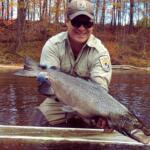
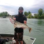
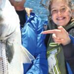
Our primary focus right now is the robust Salmo trutta population, specifically the sea-run brown trout (often referred to locally as "Salters") and resident holdovers. These fish are currently highly active in the lower tidal reaches of the Presumpscot River. Having survived the winter, they are aggressively feeding to pack on calories before the water temperatures rise significantly and the spring spawning runs commence.
Sleeper Pick: Northern Pike
Often completely overlooked by trout anglers, the impoundments above the Westbrook dams hold a thriving population of Northern Pike. As the water temperatures slowly creep upward, these apex predators shake off their winter lethargy and begin staging for their shallow-water spawn. They offer explosive action for those willing to throw larger presentations into the slack water.
Baitfish Report
Match the hatch by focusing on estuarine forage. The trout are currently keyed in on rainbow smelt dropping back or moving through the system. Furthermore, the ecosystem is anticipating the imminent arrival of river herring and alewives, which will soon push up towards Mill Brook. Lures that mimic the slender, silvery profile of a smelt or the slightly deeper body of an alewife will get the most attention from actively feeding predators.
3. TACTICAL STRATEGY
Success during the early spring requires precision. Randomly casting into open water will result in a skunk; you must read the water, understand the structure, and time your outing perfectly.
Where to Deploy
Focus your efforts on the tidal interchange between the Presumpscot Falls and the lower estuary. Steeped in industrial history, the river features old mill structures and newly formed plunge pools that offer incredible holding zones. Target the distinct current seams where the fast, oxygenated water meets the slack tide. Fish will hold in the slower water right on the edge of the seam, waiting to ambush stunned baitfish swept down by the current. Another high-percentage zone is the deep, quiet pools adjacent to the large boulders and bedrock just downstream of the Route 302 bridge.
Lure Selection
For spin anglers, slow-sinking soft plastics are vastly outperforming hard baits. Rig a 3-inch to 4-inch paddletail on a 1/8oz to 1/4oz tungsten jig head. The goal is to keep the bait near the bottom, occasionally ticking the rocks without getting snagged.
Pro Tip:When fishing paddletails in cold spring water, utilize a "low and slow" retrieve with a subtle snap-pause cadence. The strikes almost always occur on the pause as the bait flutters downward like a dying smelt.
For fly anglers, a fast-sinking poly-leader or a dedicated sink-tip line is mandatory to cut through the heavy spring flow and get the fly into the strike zone. Swing weighted Olive and White Clouser Minnows to imitate smelt, or dead-drift a heavy Black or Brown Woolly Bugger through the deeper pools to mimic leeches or large stonefly nymphs dislodged by the heavy current.
Color Selection
In clear conditions, stick to natural tones like "Natural Goby", "Root Beer", or translucent silver. If the spring runoff has stained the river, switch to high-visibility colors like chartreuse or white to give the fish a better target in the turbid water.
Bait Options
In sections where bait is legally permitted, live smelt or local shiners are highly effective. Utilize a slip-float rig—often referred to as passive trolling—to suspend the bait 3 to 5 feet below the surface. Allow the rig to drift naturally along the current seams, keeping your line mended to avoid unnatural drag.
Timing the Bite
Tide and temperature dictate the bite. Because Westbrook sits at the head of the tide, the water dynamics are constantly shifting. The incoming tide pushes bait up against the natural barriers of the falls, creating a natural trap that gamefish exploit. The golden rule for this estuary section is to fish three hours into the rising tide and three hours into the dropping tide. Avoid dead low and dead high water, as the lack of current shuts down the feeding response. Furthermore, prioritize midday tides on sunny days; a mere one-to-two degree bump in water temperature from the afternoon sun is often enough to trigger a massive feeding window.
4. REGULATIONS SNAPSHOT
Staying compliant is critical, as the Presumpscot River watershed has specific, heavily enforced rules to protect its recovering fisheries and seasonal spawning migrations.
Species
Regulation Details
Brown & Brook Trout
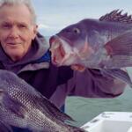
Catch and release rules heavily apply in designated spawning or sea-run zones. Specific stretches, especially near the falls, are strictly Catch-and-Release and restricted to Artificial Lures Only or Fly Fishing Only.
Northern Pike
General inland regulations apply in the impoundments above the dams. Harvest of smaller pike is often encouraged to protect the trout fishery, but check local postings for size limitations.
Sea-Run Species
A valid saltwater registry or appropriate inland license is required depending on the exact tidal boundary line you are fishing. Always consult the Maine Department of Inland Fisheries and Wildlife (MDIFW) law book for exact demarcation points.
Pro Tip:The boundary between inland and tidal regulations can be confusing near the falls. When in doubt, pinch your barbs, use artificial single-hook lures, and practice safe catch-and-release handling to ensure you are within the letter of the law.
5. REGIONAL ALTERNATIVE
Spring weather is notoriously fickle. If a heavy rainstorm causes massive runoff, turning the Presumpscot River into a muddy, unfishable torrent, you need a backup plan to save your fishing day.
Highland Lake Pivot
When the river is blown out, take the short drive north to Highland Lake. This waterbody clears up much faster than the river system and offers fantastic early-season action.
Access Point: Use the public boat launch on the southern end of the lake situated near the Falmouth/Westbrook town line.
Target Species: Pre-spawn Largemouth Bass and Yellow Perch.
Tactical Approach: Focus exclusively on the northern-facing coves and shallow flats. These areas receive the most direct sunlight and will warm up several degrees faster than the rest of the lake. Throw suspending jerkbaits with painfully long pauses (up to 10 seconds) or slowly drag small, black hair jigs across the bottom in 8 to 12 feet of water. The bass will be staging just off the first major drop-off, waiting for the shallows to reach optimal spawning temperatures.
Pro Tip:When fishing Highland Lake after a cold front pushes through, downsize your leader to 6lb fluorocarbon and use finesse presentations. The clearer water and high barometric pressure make the bass incredibly line-shy until the next warming trend stabilizes their environment.
Tight lines!
Editor's Choice: Must-Have Gear
FISHINGSIR Next-Gen Waterproof Chest Waders
★★★★★4.4 (7,370+ reviews)
2-Ply Tech: Upgraded nylon with 2.5x higher density than standard fabrics.
100% Waterproof: Lab-approved intrusion resistance with taped visible seams.
Ultra-Lightweight: Designed for all-day comfort while hunting or fishing.
As an Amazon Associate I earn from qualifying purchases. #ad
[fishing_forecast_spot]
Live Fishing Conditions: Tides, Weather & Waves
Get real‑time tides, marine weather, swell and solunar activity for each spot so you know exactly when conditions line up for your best chance at a bite.
[fishing_weather]
Fishing Spots Map
🎣
Book a Fishing Charter near Westbrook Fishing Report Today 🎣
Local guides & charters. Verified captains, instant booking, best price guaranteed.
There was an error loading the map. Please try refreshing the page.
Info
Local Access & Facilities
Westbrook Pre-Trip Checklist
Local Access & Facilities
Westbrook offers a unique angling transition zone where the freshwater dynamics of the Presumpscot River meet the tidal influence of Southern Maine. For the expert angler, this location serves as a strategic, albeit quieter, alternative to the bustling commercial wharfs of downtown Portland. The fishery here is defined by its riverine geography, providing shelter when the open Atlantic is churning with heavy swells, yet remaining close enough to the coast to serve as a launchpad for serious saltwater expeditions. The atmosphere is distinctly functional and historic; this is not a manicured resort harbor but a working-class river city where industrial heritage blends with recovering natural habitats.
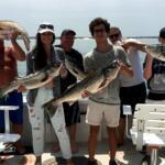
The primary draw for seasoned captains in this sector is the versatility of the water. While the casual crowd flocks to the ocean beaches, the Westbrook section of the river allows for targeted striper fishing during the migratory runs and consistent freshwater action. However, the proximity to Portland—mere miles away—means that heavy tackle anglers targeting groundfish, shark, and tuna have rapid access to the deep water fleets based in South Portland. Understanding the logistical nuances between the quiet river ramps in Westbrook and the heavy-duty marine infrastructure of the nearby harbor is the key to a successful campaign in this region.
Navigating Westbrook requires a shift in mindset from the open-ocean run. The water here demands attention to tidal flows and river currents, particularly after heavy rains. The infrastructure is understated, catering to self-reliant boaters who prefer quick launches over luxury amenities. Whether you are trailering a skiff for the river or looking to connect with a high-caliber offshore charter nearby, this hub provides a central, less congested jumping-off point for the southern Maine coast.
💡 Captain's Tip: Launch Preparedness
The local ramps at Main Street and Lincoln Street are strictly functional. There are no restrooms, showers, or fish cleaning stations on-site. Seasoned skippers know to handle all biological needs and gear prep before arriving at the launch, as these facilities are "launch and go" locations designed for efficiency, not comfort.
Access & Getting There
Accessing Westbrook is straightforward for those trailering boats via the Maine Turnpike (I-95). The city lies just west of Portland, allowing anglers to bypass some of the heavier downtown congestion associated with the Old Port tourist district. However, traffic on the local arteries can thicken during the commuter windows of 7:00 AM to 9:00 AM and again in the late afternoon. For the dawn patrol angler, the roads are generally wide open, but be mindful of seasonal construction that frequently occurs during the short Maine summer.
The boat launch situation in Westbrook is defined by two primary municipal access points: the Main Street Boat Ramp and the Lincoln Street Boat Ramp. These are situated very close to one another, separated by less than half a mile along the river. Both ramps feature paved surfaces and, crucially for the traveling angler, offer dedicated trailer parking. However, the ramps can be slick at low tide due to river silt and algae accumulation. Four-wheel drive is recommended for heavier vessels, particularly when the river level is low, to avoid traction issues on the recovery.
Weather plays a significant role in access strategies here. Unlike the exposed coastal ramps in Casco Bay, the Westbrook river ramps offer significant protection from the prevailing offshore winds. When a Nor'easter or heavy trade wind makes launching at the coast dangerous or miserable, the Presumpscot River ramps often remain fishable and calm. However, anglers must be vigilant regarding river currents; heavy inland rainfall can turn the launch areas into fast-moving turbulent zones, making solo launching hazardous.
Parking at the ramps is generally available, but security is basic. It is advisable to lock trailers and remove valuables from the vehicle, as these are public, unmonitored lots. For anglers not towing boats but heading into Portland to jump on a charter, parking is a different beast. Garages like the Elm St. Parking Garage or Simba Parking in Portland are reliable but located over 5 miles away from the Westbrook center. These garages are not suitable for trailers, so drop your rig at a secure location before heading into the city.
💡 Captain's Tip: Weather Contingencies
If the marine forecast calls for seas exceeding 4 feet or winds above 15 knots from the Northeast, scrub the offshore mission and utilize the Main Street ramp. The river valley provides a natural windbreak, allowing you to salvage the day with light tackle casts for holdover stripers or freshwater bass.
Facilities & Amenities
The infrastructure in Westbrook is characterized by a distinct lack of "dockside" amenities, which the experienced captain must anticipate. The local boat ramps are bare-bones operations. There is no fuel dock on the river here; all vessels must be fueled on the trailer at highway gas stations before launching. Similarly, there is no ice or bait available directly at the Main Street or Lincoln Street ramps. Anglers must procure salt ice, bait, and provisions at local convenience stores or specialized shops in the greater Portland area before hitching the trailer.
While Westbrook itself is light on marine services, the nearby South Portland and Scarborough areas (roughly 6 to 9 miles away) host a fleet of high-caliber charter operations. For anglers looking to outsource the heavy lifting, outfits like Teazer Charter and Kristin K Charters in South Portland are rated highly for deep sea expeditions. Reel Salty Charters Maine in Scarborough is another reputable option for those targeting pelagics. These operators are accustomed to serious clientele and typically run heavy diesel sportfishers capable of reaching the offshore banks.
Accommodation for the traveling angler requires strategic planning. There are no motels directly adjacent to the boat ramps suitable for a "roll out of bed and launch" scenario. The nearest camping facilities suitable for towing anglers, such as Little Ossipee Lake Campground or Sebago's Crooked River Campground, are a significant haul, located between 18 and 20 miles inland. For those prioritizing an early start, booking a standard hotel in the Portland periphery is often the most logistical choice, provided they offer ample trailer parking—a detail that must be confirmed by phone in advance.
Facility Name
Type
Trailer Parking
Amenities
Distance from Center
Main Street Boat Ramp
Boat Launch
Yes
None (No Restrooms/Lights)
0.4 miles
Lincoln Street Boat Ramp
Boat Launch
Yes
None (No Restrooms/Lights)
0.4 miles
Teazer Charter
Charter Fleet
No
Deep Sea / Offshore
6.1 miles
Kristin K Charters
Charter Fleet
No
24-Hour Operations
6.5 miles
💡 Captain's Tip: Negative Knowledge
Do not expect to find bait or tackle at the water's edge in Westbrook. The nearest specialized marine support is in South Portland. If you break a prop or forget your leader material at the Main Street ramp, you are looking at a 20-minute round trip minimum to rectify it.
Permits, Regulations & Fees
Fishing in this region falls under the jurisdiction of the State of Maine, and adherence to regulations is strictly enforced to protect the recovering river ecosystems and coastal stocks. While the local ramps at Main and Lincoln Streets do not currently list a specific launch fee in the provided data, anglers should always carry small denominations of cash in the event of seasonal municipal changes. The primary regulatory consideration here is the distinction between freshwater and saltwater licensing. Since the Presumpscot River is tidal, anglers must be cognizant of the demarcation lines where a freshwater license transitions to a saltwater registry requirement.
A major conservation entity in the wider region is the Rachel Carson National Wildlife Refuge. Although its headquarters and primary lands are located approximately 24.5 miles south in Wells, its influence on the conservation ethic of the southern Maine coast is profound. The refuge protects vital salt marshes and migratory bird habitats. Anglers venturing out of the river and south along the coast must be aware of refuge boundaries. Special restrictions often apply to landing on refuge islands or disturbing the marsh grass. The refuge was established to preserve migratory routes, and respecting these "Kapu" (forbidden/sacred) zones is essential for the continued access of recreational fishermen.
Ethical angling in Westbrook also involves respecting the shared use of the river. The Presumpscot is a historic waterway that flows through urban areas. Anglers should be mindful of noise levels in the early morning near residential zones and maintain a "wake-less" speed until clear of the launch and bridge structures. There are no specific "permit entrances" listed for the boat ramps themselves, implying open public access, but the lack of on-site staff means that self-policing regarding trash and parking etiquette is vital to keeping these ramps open.
Events & Seasonal Information
The fishing calendar in Westbrook is dictated by the seasonal migration of striped bass and the thermal dynamics of the river. The season typically kicks into high gear in late spring when the alewives and herring push into the river systems, drawing game fish behind them. During the height of summer, the boat traffic on the river increases significantly with recreational paddlers and pleasure boaters. The seasoned angler knows that the prime window for uninterrupted fishing is the "dawn patrol"—launching by 5:00 AM to work the structure before the sun and the crowds rise.
While Westbrook itself does not host major offshore tournaments, the nearby Portland harbor is a hub for summer billfish and tuna competitions. During these peak weeks in July and August, the availability of charters like Morning Flight or Reel Salty becomes scarce. Advanced booking is absolutely required if you plan to fish during the bluefin tuna season. Furthermore, the traffic on the I-95 corridor and Route 1 swells with tourist volume, turning a normally short drive into a logistical headache. Plan your haul-out times accordingly to avoid the late afternoon gridlock.
Seasonal weather shifts are sharp here. By late September, the recreational traffic vanishes, but the winds begin to clock around to the north. This is often the most productive time for the river angler, as the cooling water temperatures trigger a heavy feed before the winter dormancy. However, the ramps are not maintained for ice, so access effectively ceases once the hard freeze sets in, usually by late November or December.
Contact Information & Resources
For official inquiries regarding conservation zones and wildlife regulations, the Rachel Carson National Wildlife Refuge can be reached at 207-646-9226 or via email at RCNWR@fws.gov. While they are not the harbor masters for Westbrook, they are the authority on the regional coastal environment. For parking issues in the greater Portland area, the Portland Parking Division is available at (207) 874-8443.
Safety is the sole responsibility of the captain. There is no dedicated harbor patrol stationed at the Westbrook ramps. In the event of an on-water emergency, standard VHF Channel 16 protocols apply, but be aware that river topography can sometimes block radio signals to the Coast Guard stations on the coast. Cell phone coverage is generally reliable in this urban interface. Always file a float plan with a contact on land before departing.
For precise locations of the boat ramps, real-time weather data, and the specific locations of the charter fleets mentioned, consult the live dashboard and interactive maps below.
Our spot reports combine data-driven forecasts with curated local information. The forecast is generated by our proprietary Fishing Score algorithm (0–100%), which analyzes real-time data from Open-Meteo API, validated against NOAA CO-OPS tide gauges and USGS water-monitoring stations. The model weights tide dynamics (35%), wave energy (25%), wind patterns (20%) and time of day (20%)—factors shown to influence fish feeding behavior through marine-biology research and decades of charter log data.
Access, facilities and services information for each fishing spot is sourced from official datasets such as Recreation.gov (RIDB), state park & wildlife agencies, and geospatial providers like Google Maps. These sections undergo scheduled re-validation every 3–6 months to ensure that boat ramps, park access, contact details and local services remain accurate.
Narrative sections (catches, seasonal behavior, local tips) are synthesized from these data sources and refined following the Fishing Reports Today editorial guidelines, combining bibliographic research from ichthyology and oceanography with expert angler experience. Our team reviews reports on a regular basis, while the forecast model itself updates every 6 hours for real-time accuracy.
⚠️ Important: Always verify current local regulations, access restrictions and weather conditions before fishing. These reports are intended as a planning aid, not a guarantee of catches or safety. When in doubt, contact local authorities or park managers listed on the page.
To provide the best experiences, we use technologies like cookies to store and/or access device information. Consenting to these technologies will allow us to process data such as browsing behavior or unique IDs on this site. Not consenting or withdrawing consent, may adversely affect certain features and functions.
Functional Always active
The technical storage or access is strictly necessary for the legitimate purpose of enabling the use of a specific service explicitly requested by the subscriber or user, or for the sole purpose of carrying out the transmission of a communication over an electronic communications network.
Preferences
The technical storage or access is necessary for the legitimate purpose of storing preferences that are not requested by the subscriber or user.
Statistics
The technical storage or access that is used exclusively for statistical purposes.The technical storage or access that is used exclusively for anonymous statistical purposes. Without a subpoena, voluntary compliance on the part of your Internet Service Provider, or additional records from a third party, information stored or retrieved for this purpose alone cannot usually be used to identify you.
Marketing & Affiliates
The technical storage or access is required to create user profiles to send advertising, or to track the user on a website or across several websites for similar marketing purposes, including affiliate tracking for products recommended in our reports.


Leave a Reply